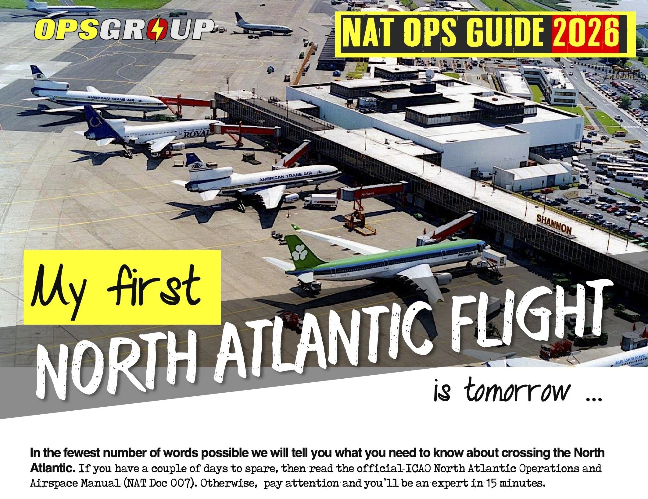
North Atlantic Plotting Chart (2026)
North Atlantic Plotting Chart (2026)
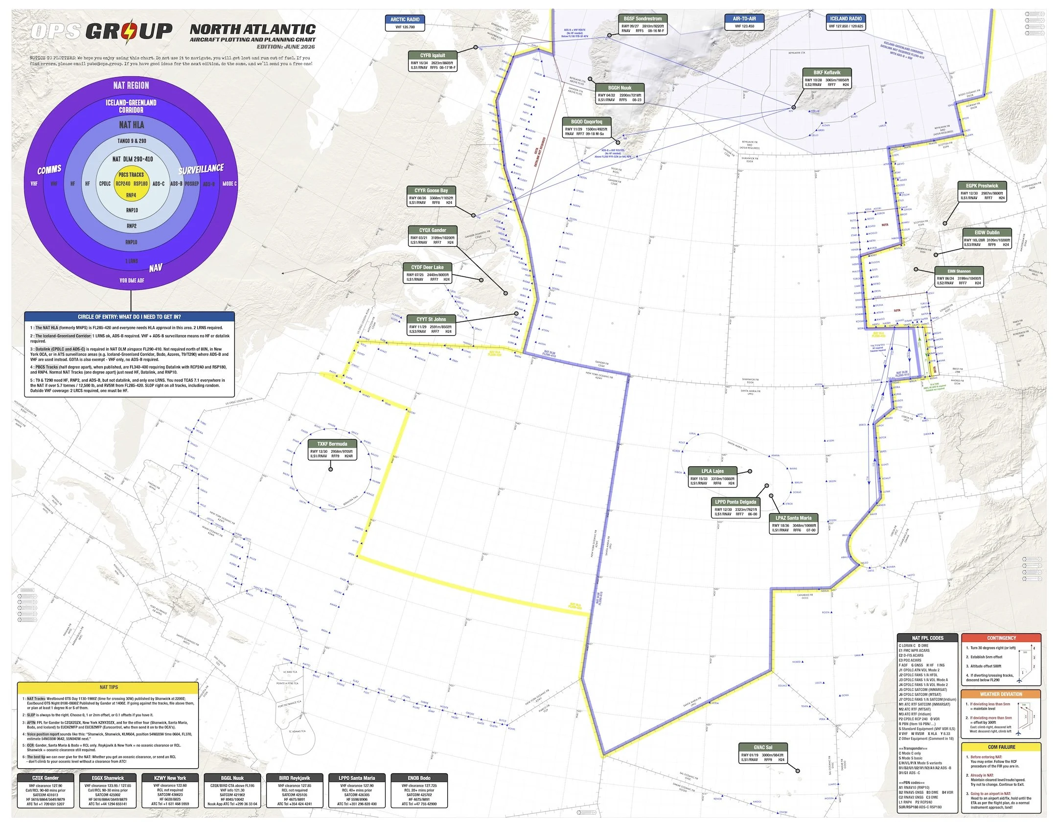
This is a Hi-Res North Atlantic Plotting and Planning Chart in PDF format showing North Atlantic Oceanic Airspace, Shanwick, Gander, Reykjavik, Bodø, New York, Santa Maria, and adjoining domestic airspace, with easy to read NAT Tips, Airspace requirements, Emergency procedures, and much more!
This chart effective: June 2026
Free for OPSGROUP Members - get it in your Dashboard under Guides and Charts.
Changes in this updated edition (June 2026):
FULLY UPDATED for 2026!
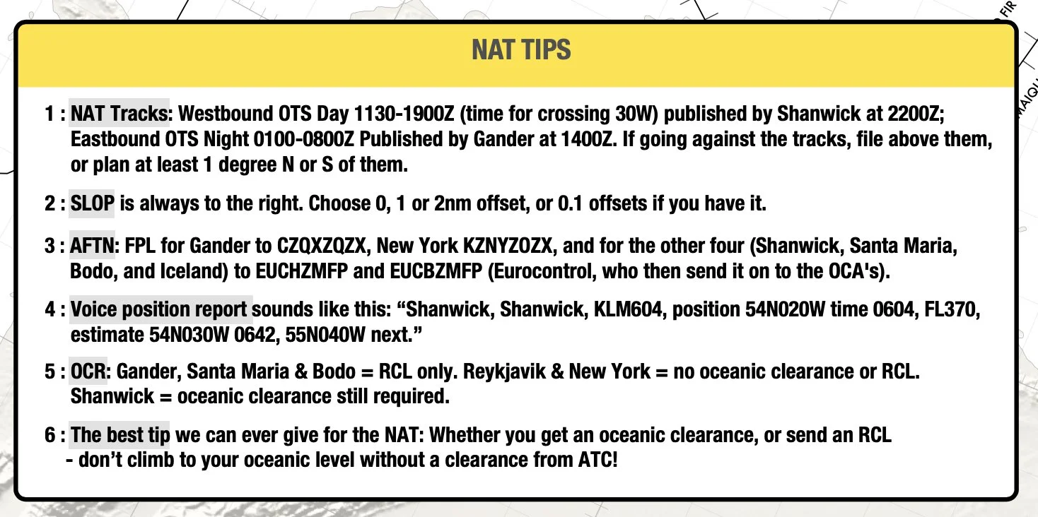
NAT Tips: now shows current OCR/RCL procedures across all NAT FIRs, including Gander, Shanwick, Reykjavik, New York, Santa Maria, and Bodo.
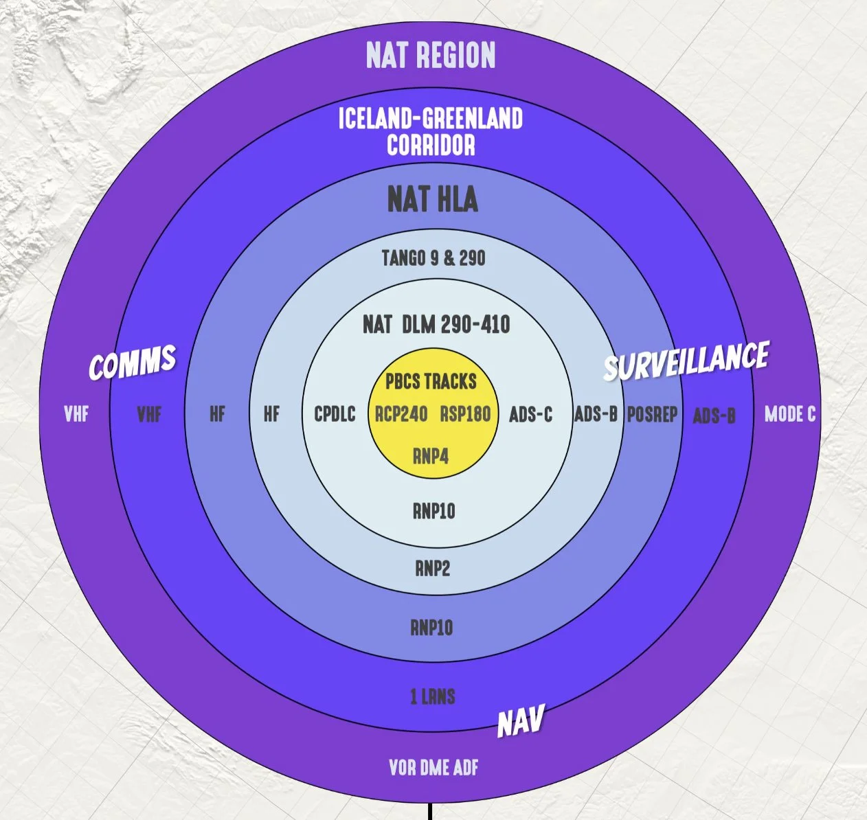
NAT Airspace Circle of Entry 2026: clearer view of NAT HLA, DLM, surveillance areas, and where datalink is or isn’t required.
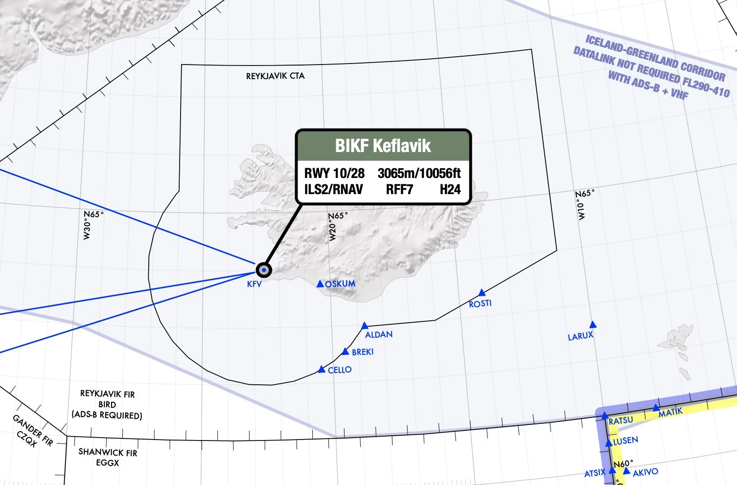
Iceland-Greenland corridor and VHF routes: updated post-Blue Spruce routings, including current ADS-B and VHF requirements.
BIRD/Reykjavik FIR 2025 ADS-B requirement: now shown on the chart.
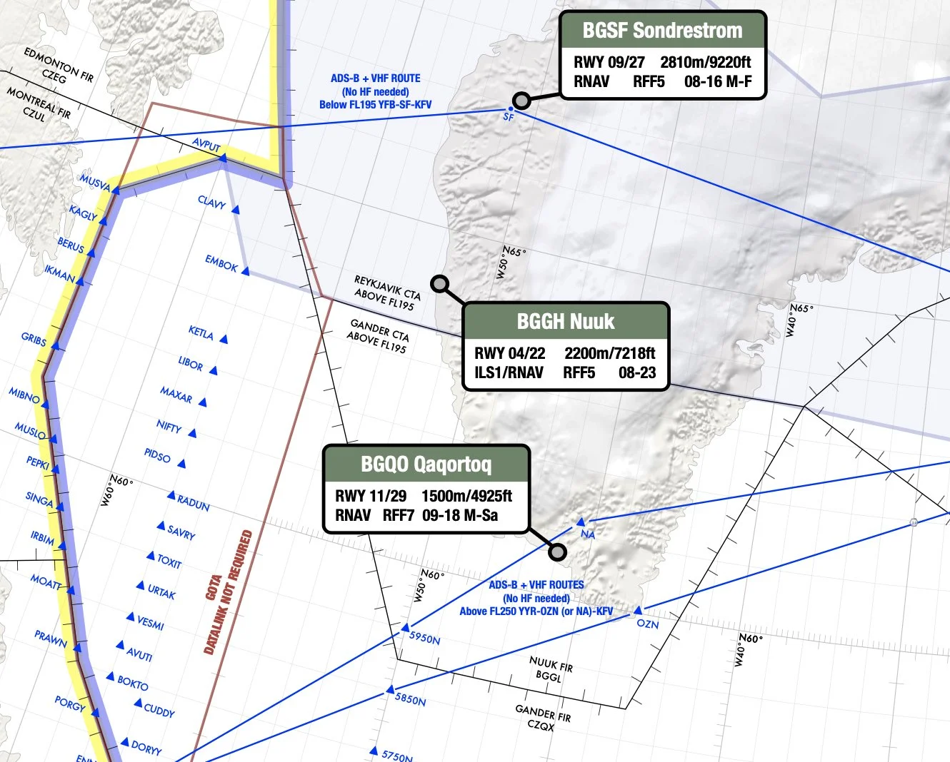
Greenland alternates: BGGH/Nuuk and BGQO/Qaqortoq added, BGBW/Narsarsuaq removed.
Additional diversion airports added: with runway, approach, length, RFF, and hours.
Chart Features: (Cycle images above to see examples)Requirements for NAT tracks, PBCS tracks, datalink mandate.
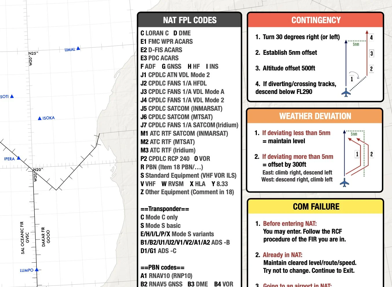
NAT FPL codes, clearance frequencies, Satcom, HF, and RCL timings.
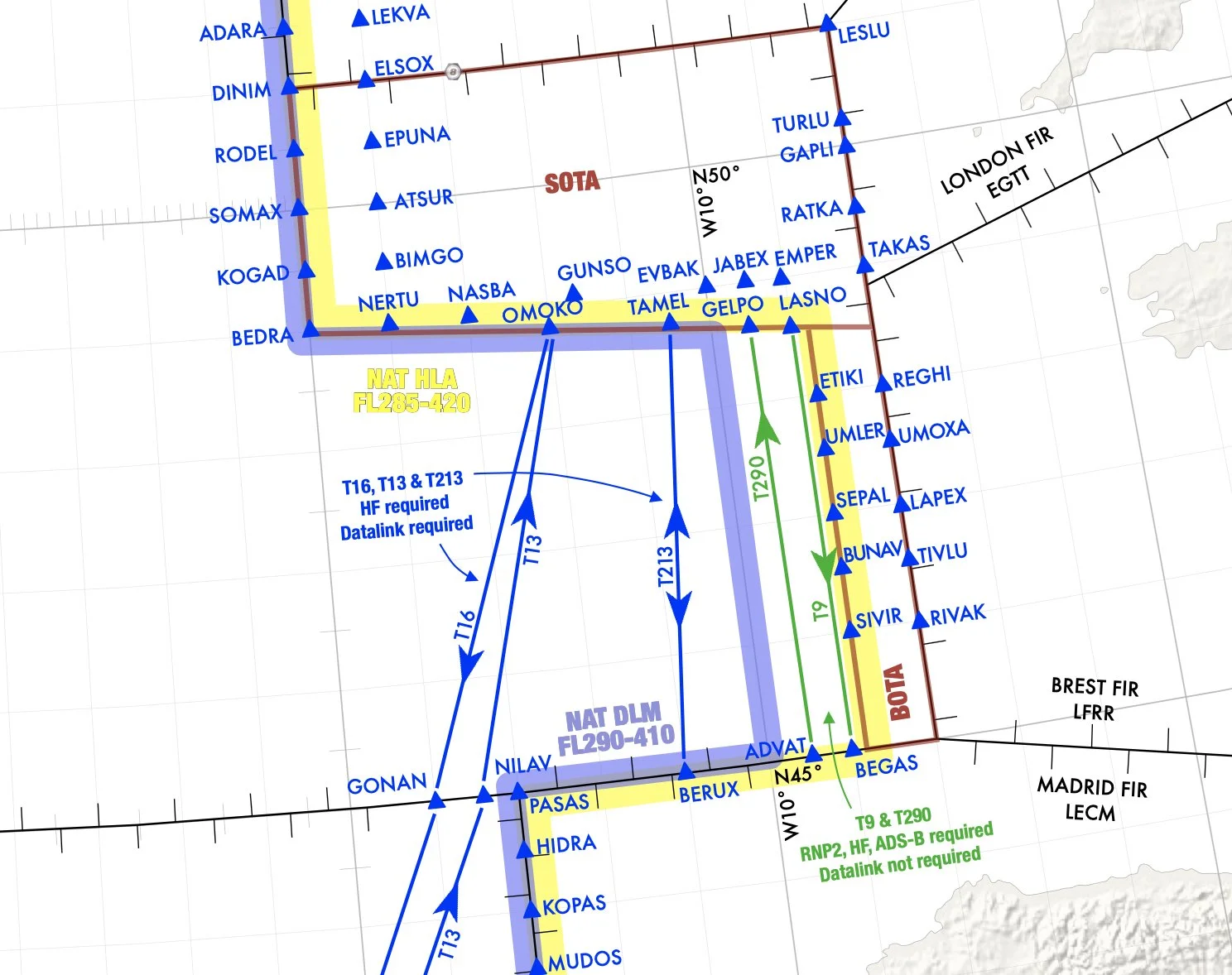
All NAT Entry/Exit points with associated required landfall fixes.
Quick reference for contingency, weather, and comms failure with easy graphics.
Easy view of boundaries for HLA and DLM/Datalink mandated airspace.
and … Treasure Boxes!
Digital Download:
:: On order, you will immediately receive a link to download the PDF of this chart.
:: View on iPad, EFB, Laptop, Mac or PC - standard PDF file
:: Prints in high-res.
:: Questions? Just contact shop@ops.group
5,000+ copies sold! Get yours now ...
Prefer to get this for free?
With an OPSGROUP membership, all publications like this from the group - current and future - are free of charge and emailed to you directly on publication. Join with an individual, team, or airline/dept membership: ops.group/membership - and connect with 9000+ other pilot, dispatch, ATC, and operations members. Scroll down for more about OPSGROUP.
Prefer not to join? No worries, just add the items you need to your cart and checkout - you'll get them immediately.
This is a Hi-Res North Atlantic Plotting and Planning Chart in PDF format showing North Atlantic Oceanic Airspace, Shanwick, Gander, Reykjavik, Bodø, New York, Santa Maria, and adjoining domestic airspace, with easy to read NAT Tips, Airspace requirements, Emergency procedures, and much more!
This chart effective: June 2026